
As a whitewater paddler, I’ve always wanted to see the world class rapids of the Russell Fork. It was the expert test piece for my era, steep and difficult–and well beyond my skill level. I never wanted to run it, but stories around campfires of rapids with names like Fist, Broken Nose, and El Horrendo told me this was a place that I needed to see. It’s on the Virginia-Kentucky border, a long way from home, but I was in the neighborhood last week (visiting Abingdon). That’s only an hour and a half away, so it seemed like the perfect chance to stop by.


Paddlers see rivers as full of opportunity, but they can sometimes be entirely too full. I learned that early on, having lived in Rapid City, South Dakota right before it was hit by a terrible flood. In June of 1972, a storm dropped fifteen inches of rain in just six hours, and a wall of water from Canyon Lake took the lives of 238 people. My family had just moved away, so we didn’t experience the flood firsthand—but all of our friends had stories, and that event and its aftermath has defined the town for a couple of generations. I’ve always looked at their recovery and rebuild–including a reconfigured Canyon Lake, a beautiful park, and an annual memorial walk–as a testament to the strength of the human spirit.


Flashing forward, none of that was on my mind when planning to visit the Russell Fork, which I always viewed as a kind of “serious recreation.” This was going to be a quick trip to gawk at rapids…well, at least until I stumbled on the tale of nearby Pikeville, Kentucky.
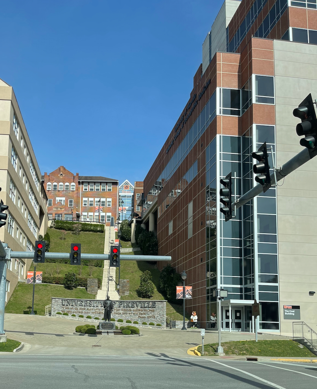
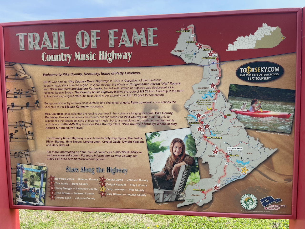
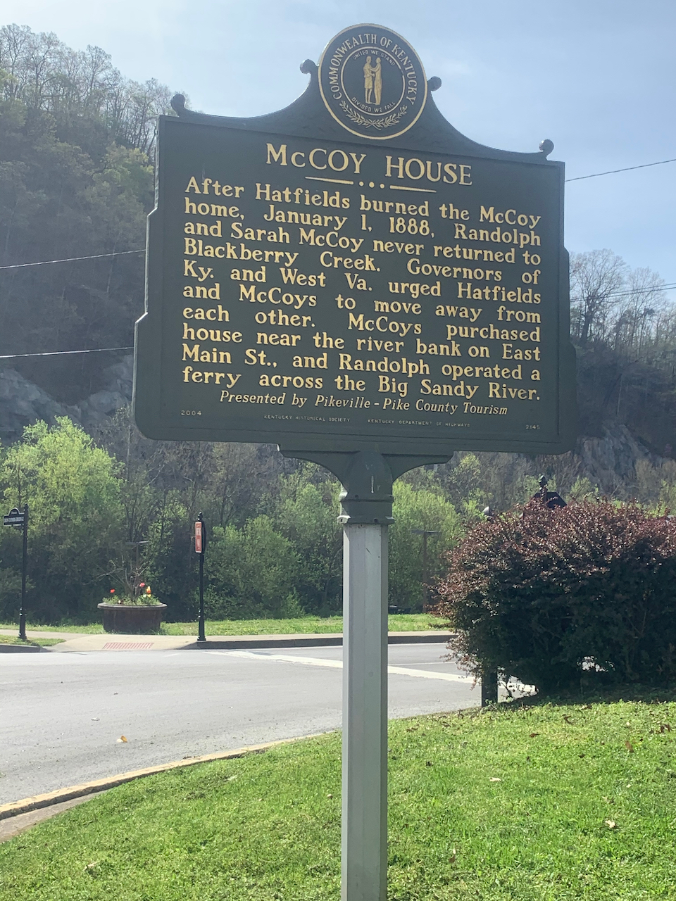
Pikeville is a town of 7,000 in the same watershed, just downstream, and it’s got an interesting history. For starters, it holds a prominent place in the Hatfield-McCoy feuds of the 1800s. In more recent times, it is home to Pikeville University and is the birthplace of country singer Patty Loveless.
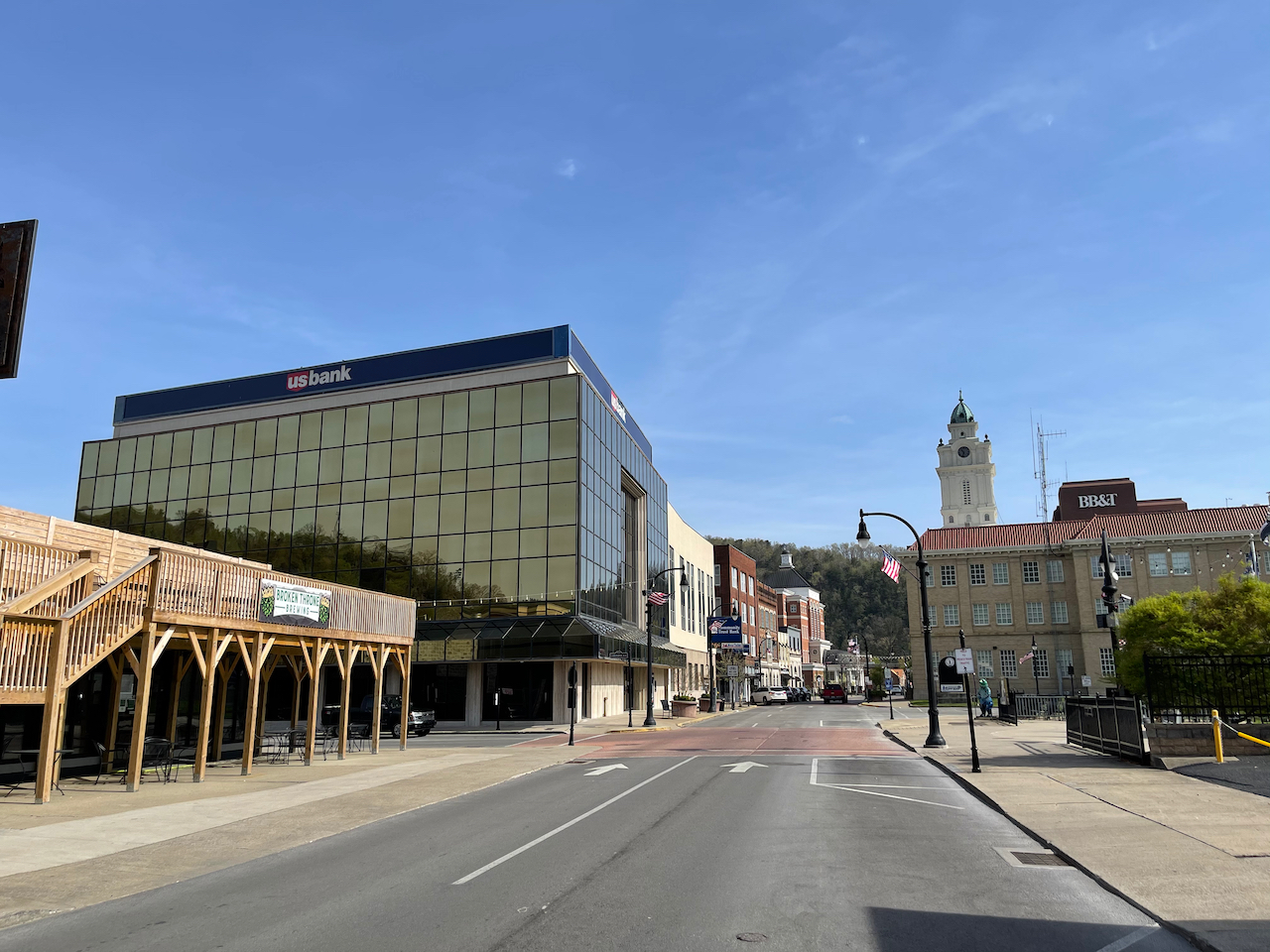

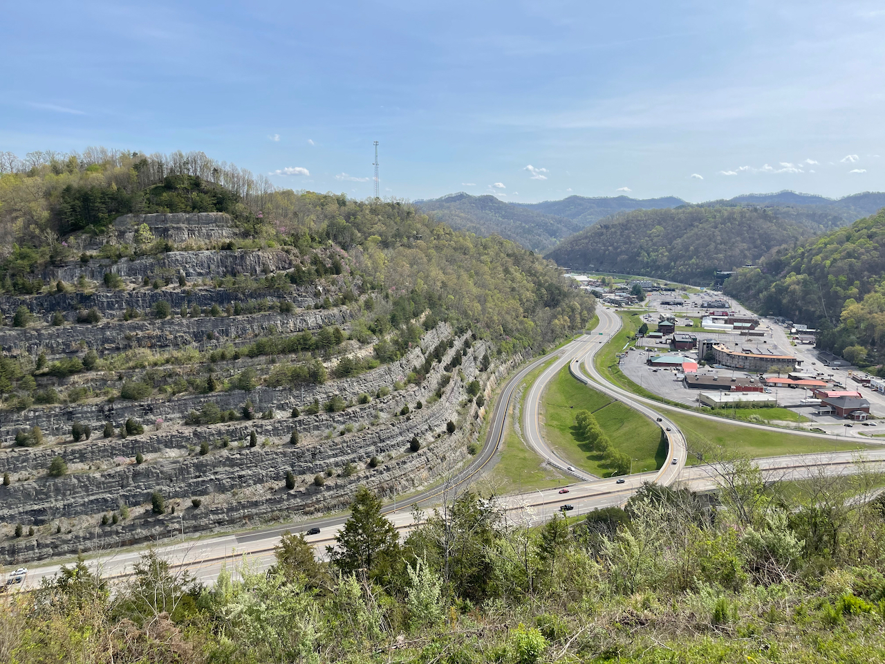
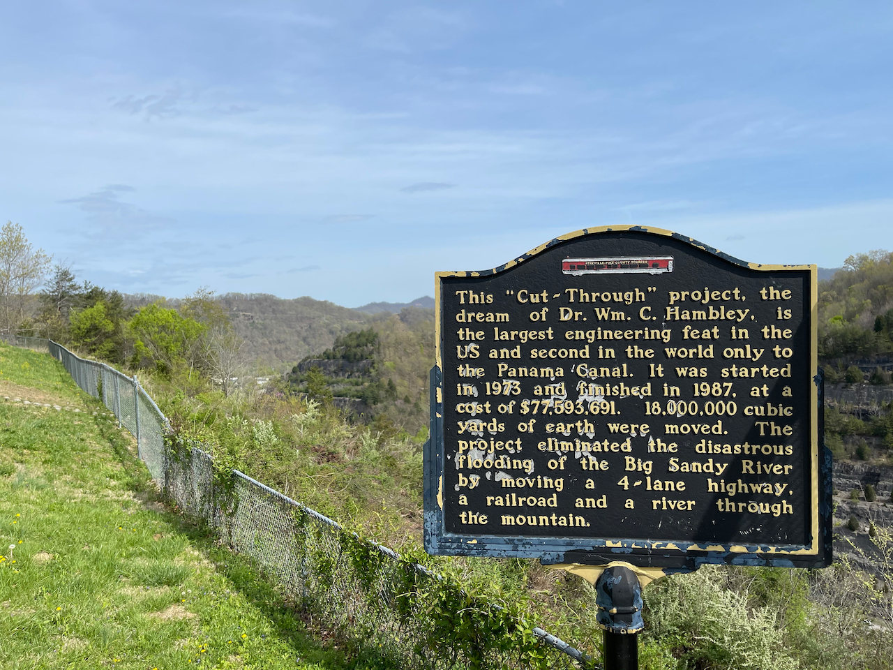
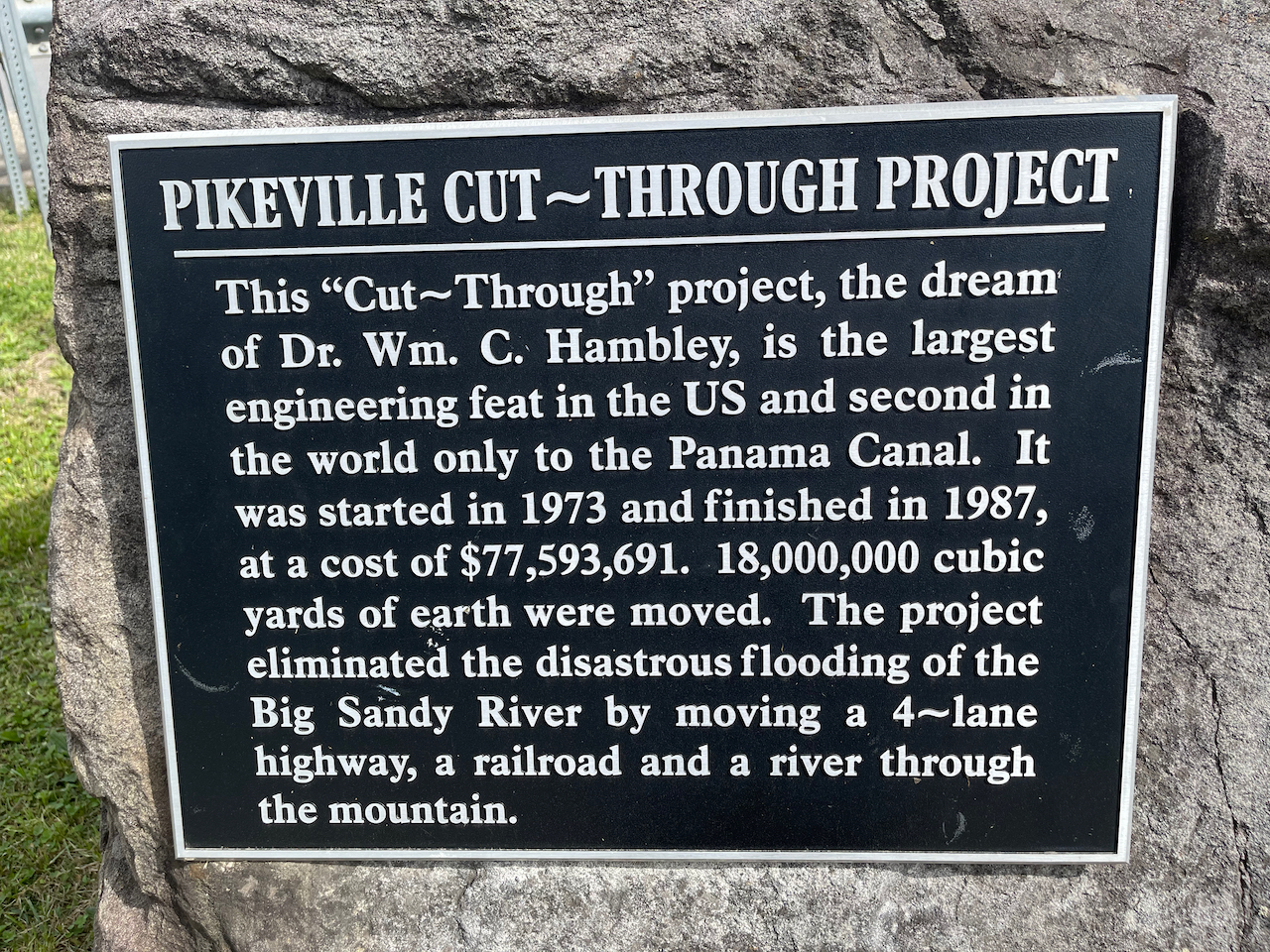
But what drew us to Pikeville wasn’t a family feud or a country musician. Rather, it was a massive engineering project called the Pikeville Cut-Through. Finished in 1987, the Cut-Through re-routes the Levisa Fork of the Big Sandy River (the Russell Fork is a tributary) through a man-made channel in the mountain. Prior to the cut, flooding occurred on an almost annual basis (it was particularly bad in 1977). Much of the land in Pikeville’s central business district was basically unusable.


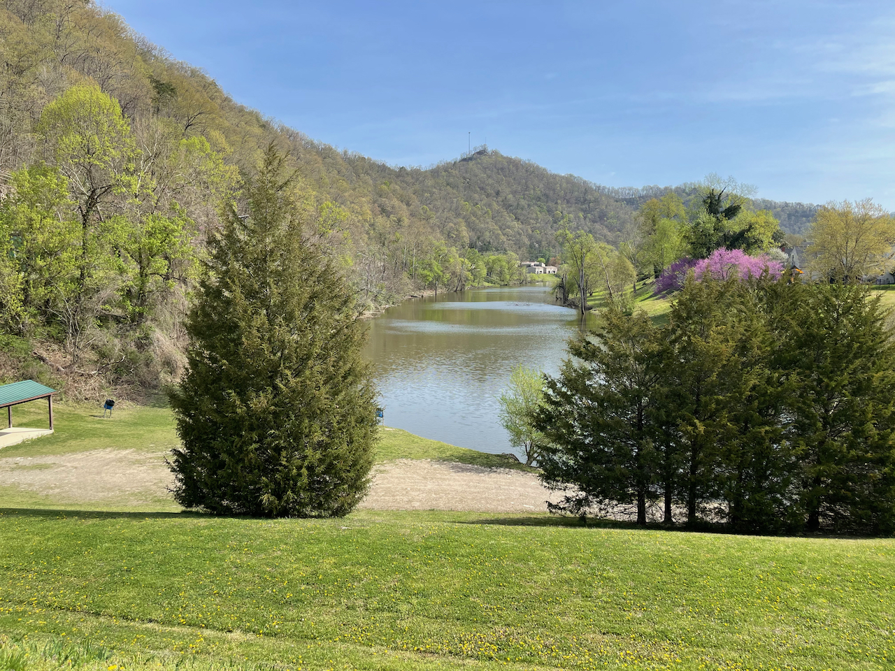
The town responded with an amazingly ambitious $77M project. Over a period of 14 years, they moved 18 million cubic yards of earth and relocated the river bed to the west of town. The new passage is 600 feet deep and 3700 feet long–not natural beauty, but still quite a sight. The impact has been profound: a more protected downtown, a new railroad bypass, and even a new recreational park where the old river bed used to be.


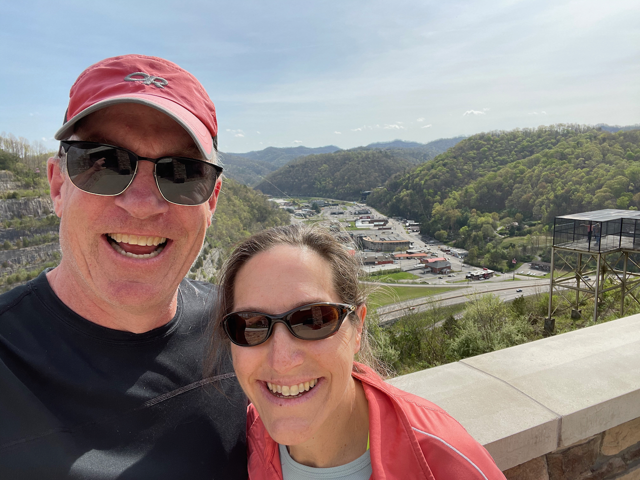
A massive road cut maybe isn’t worthy of a postcard…but it certainly seemed worthy of a visit. So we stopped through and marveled at one community’s response to adversity. Much like Rapid City’s rebuild after the flood of ’72, Pikeville has charted a new course for both the water and the town. These days the city center is doing ok, and it’s certainly much drier and much safer. It’s an amazing transformation; I’d love to have been in some of the early conversations when they dreamed this up.


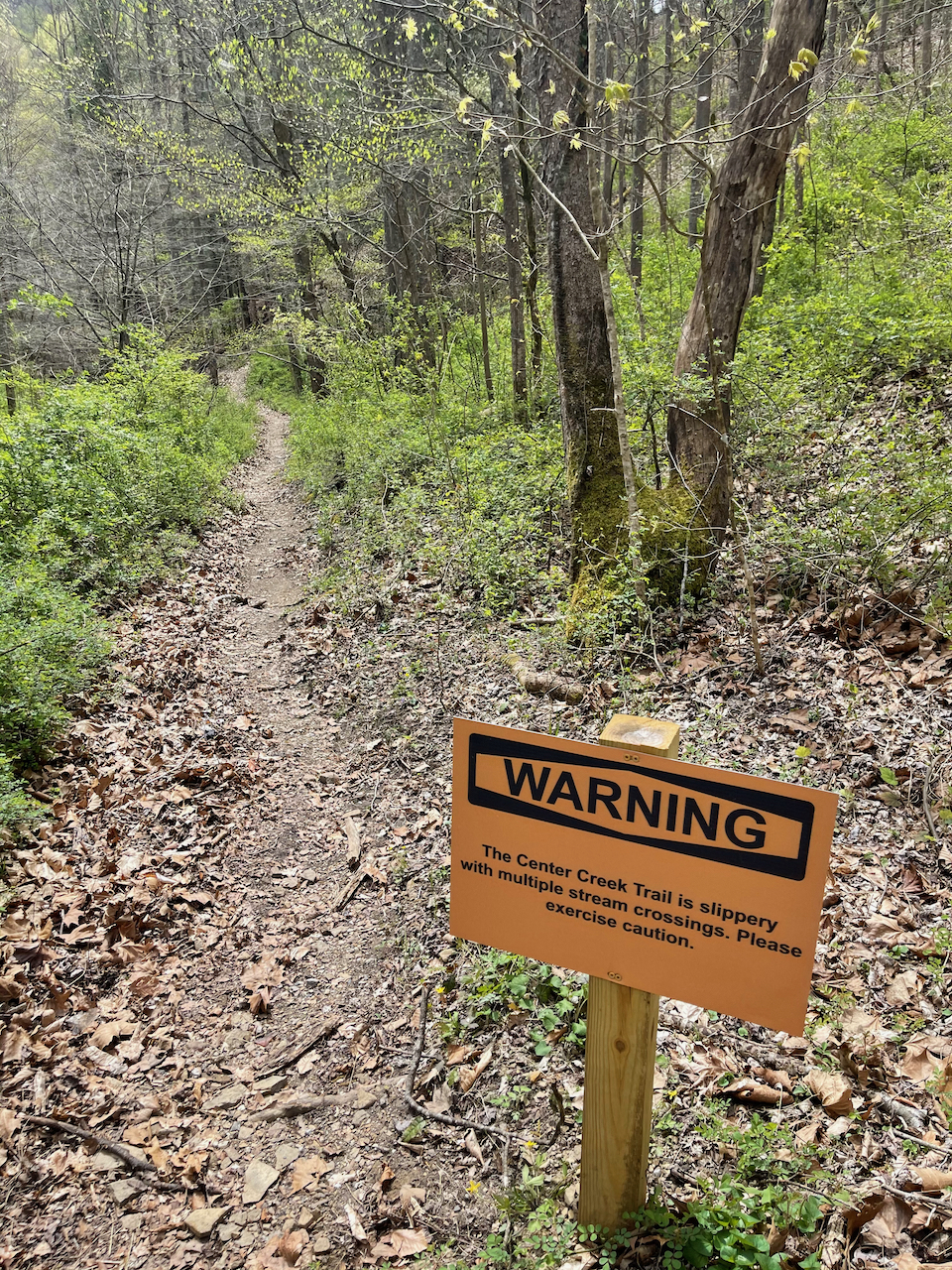
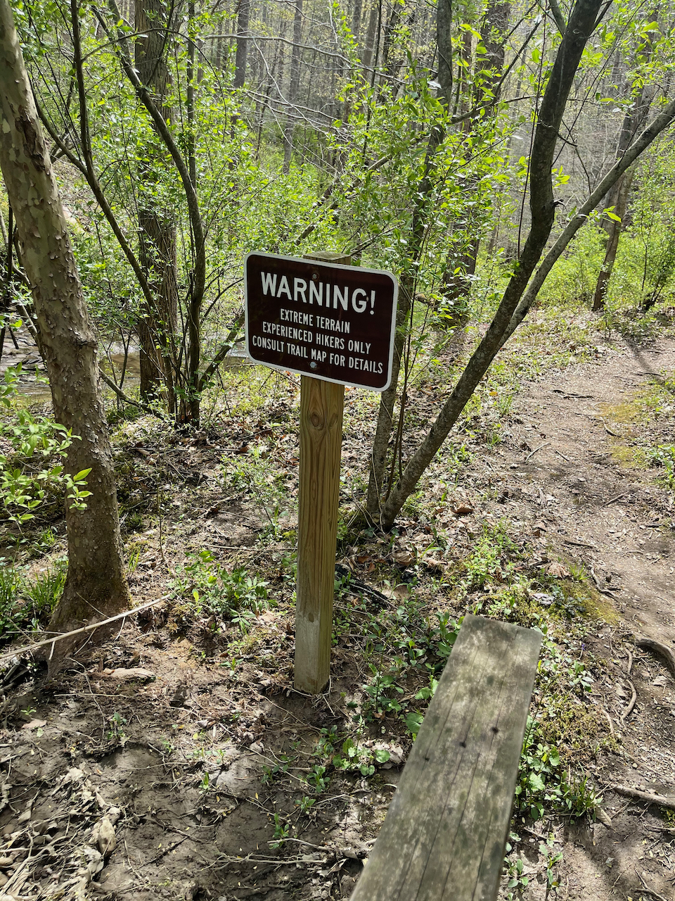
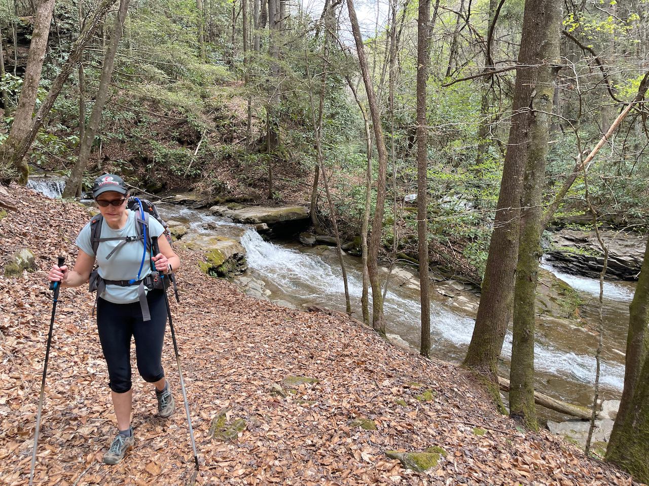
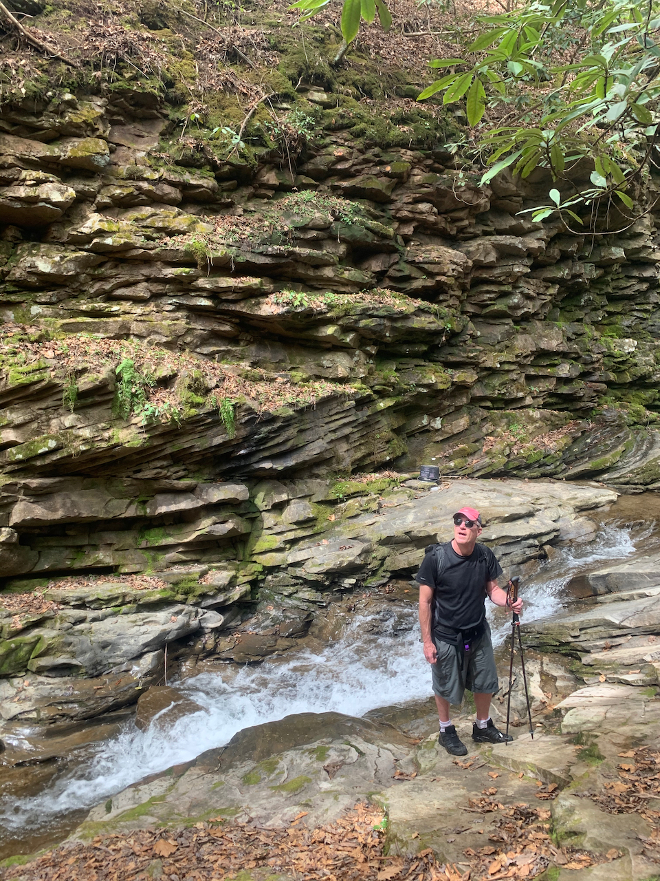
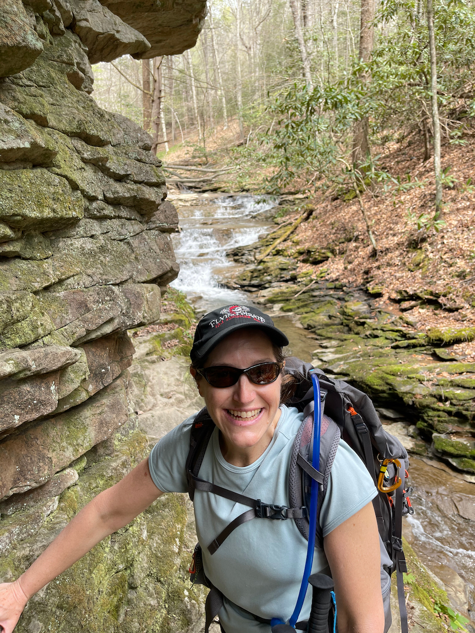
After our visit to Pikeville, we drove upstream to the Russell Fork to appreciate a different kind of beauty. We wanted to see the rapids, so we took a devious path down towards the river through a primitive trail along Center Creek. We scrambled about a half mile or so, past signs that warned of extreme hiking, and into a poorly marked section that was tricky to follow. From there, we hopped and waded across slick rocks and through a tight canyon. The hiking was sporting (a climber’s term for “dangerous”), with delicate scrambles on slanted rocks above the creek. It was beautiful in there, but definitely a place to walk with deliberation.
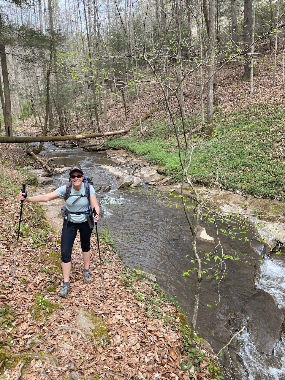
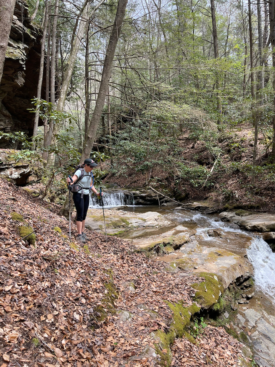
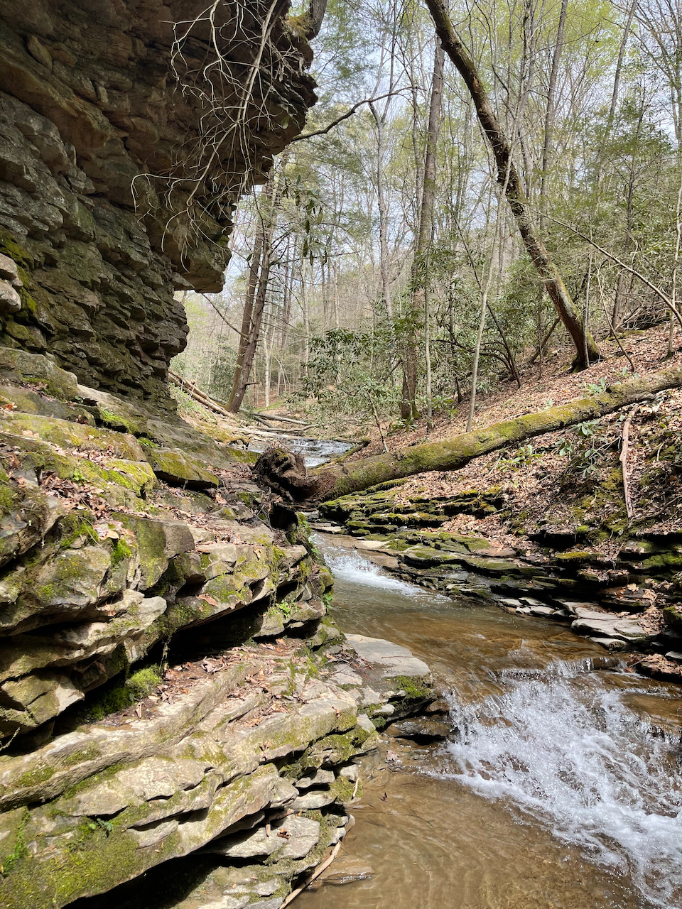
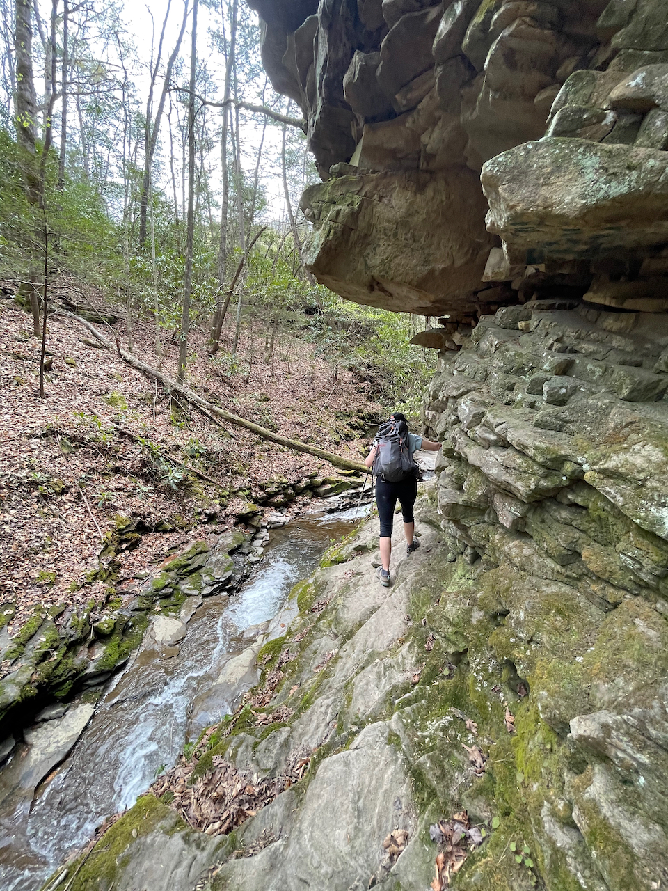
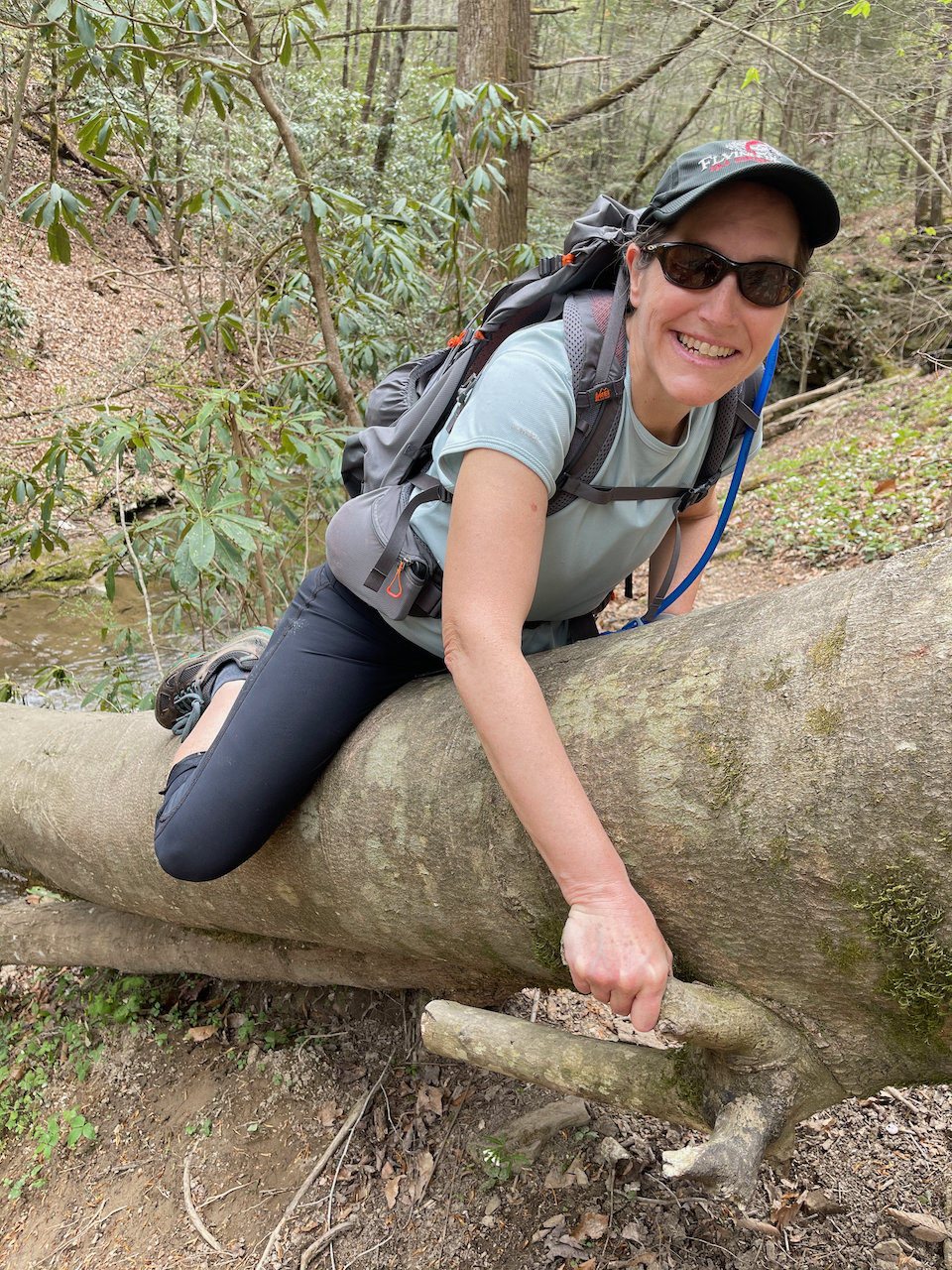
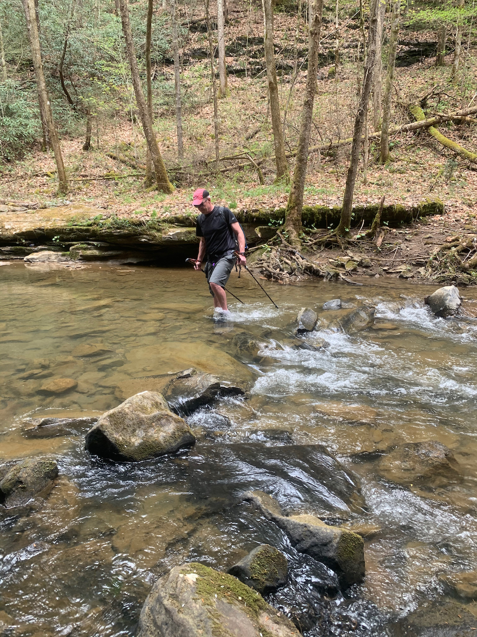
As we got further in and forded the creek, we noticed dark clouds approaching from the west. At that point, we started to worry about the canyon flashing. Debris high on the walls told us that was a real possibility. And looking at the maps, it wasn’t clear if there was a good way to get back to the trailhead if the creek came up even a little bit.
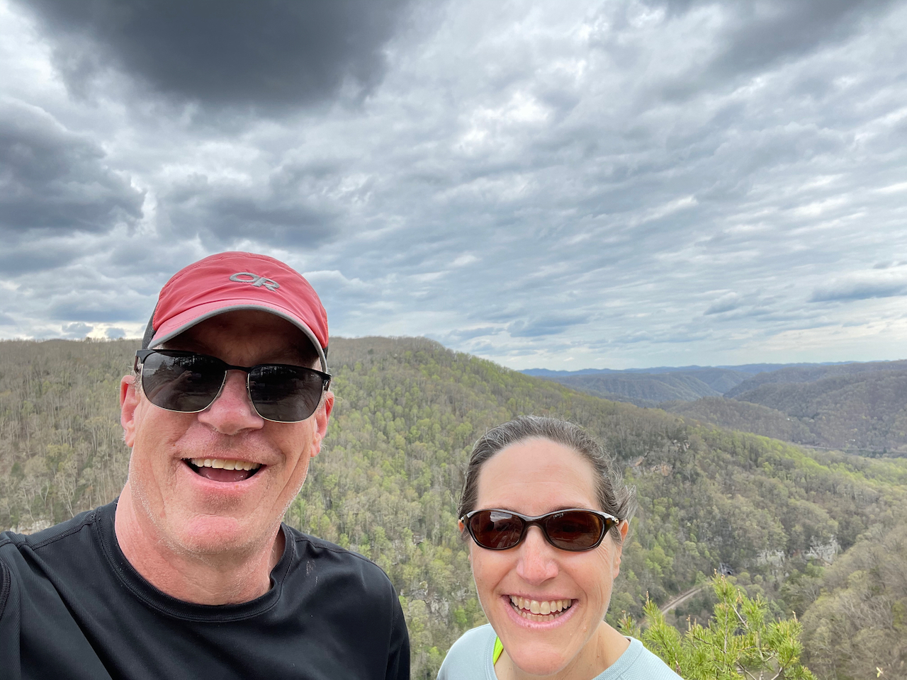
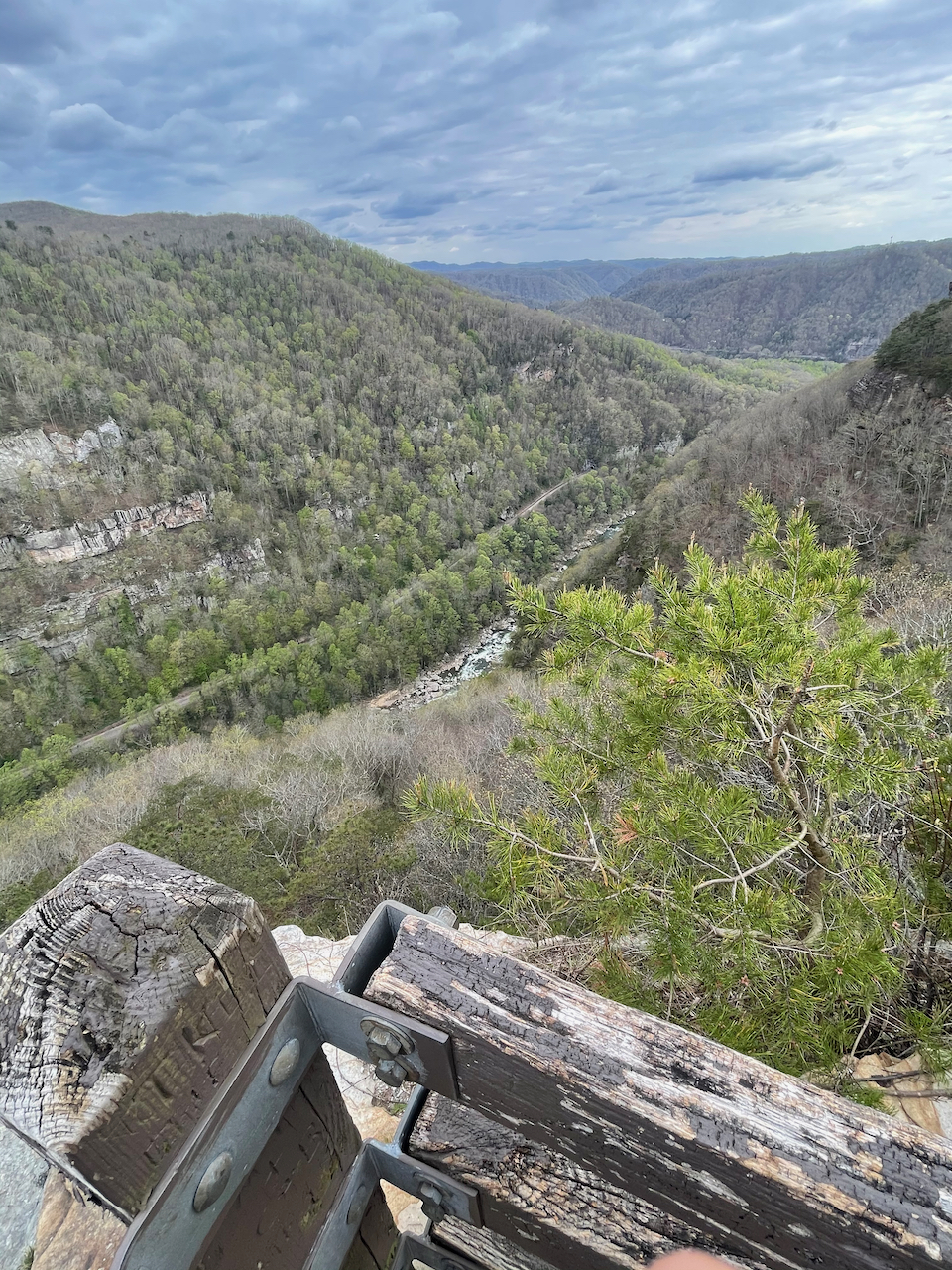
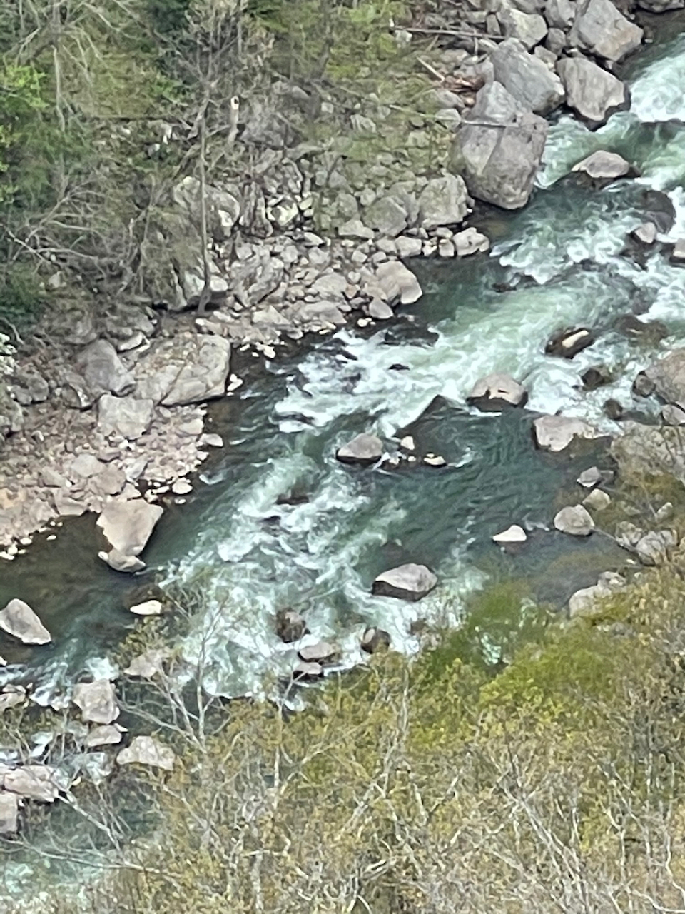
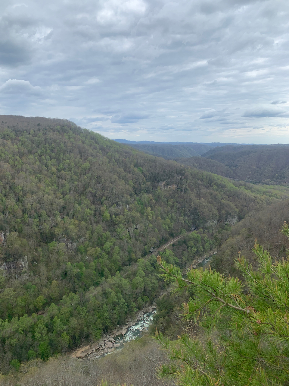
Having just seen one community’s nod to the power of moving water, the smart play was to turn around. So we did, and I still haven’t seen the rapids of the Russell Fork (well, except later from the canyon rim at Breaks Interstate Park, beautiful, but not really the same as being next to the river). All told, we hiked maybe a mile round trip. Sometimes you have a little adventure, and sometimes you have little adventure.


In the end, our trip to see world class whitewater–fresh from visiting a massive flood control project–changed course due to the prospect of high water in a tiny creek. That’s either crazy symmetry, bitter irony, or poor planning…maybe all three.
Wow! Very cool history! I never even heard of this project!
Well, we hadn’t, either. Quite a sight, and quite a project!
Your little adventure is a lot of reading pleasure for me:) Txs!
I’m revisiting some of your earlier posts after reading about the Alaska trip. I feel such kinship with you both, despite the fact that we don’t see each other very often. Someday I’d love to do a trip with you! Or even have you come up for a few days visit. When are you retiring?! LOL
Well, we definitely need to share an adventure! And we are long long overdue for Connecticut. You are our retirement models, by the way. We are always playing catch-up to you two!
And I know this area! When I was in college in Cincinnati, I camped near the Russell Fork a few times. And Mike Blackburn always regaled me with his trips down that river.
Some day maybe I’ll actually see the river up close…maybe with better planning!